METHOD for collecting Data
Prior to our work, transit data for Nairobi was inaccessible, inconsistent, and unreliable. To address this problem we worked from scratch to devise a standard protocol and methodology for creating a route map along with a GTFS compatible data structure.
Data Collection in the Field
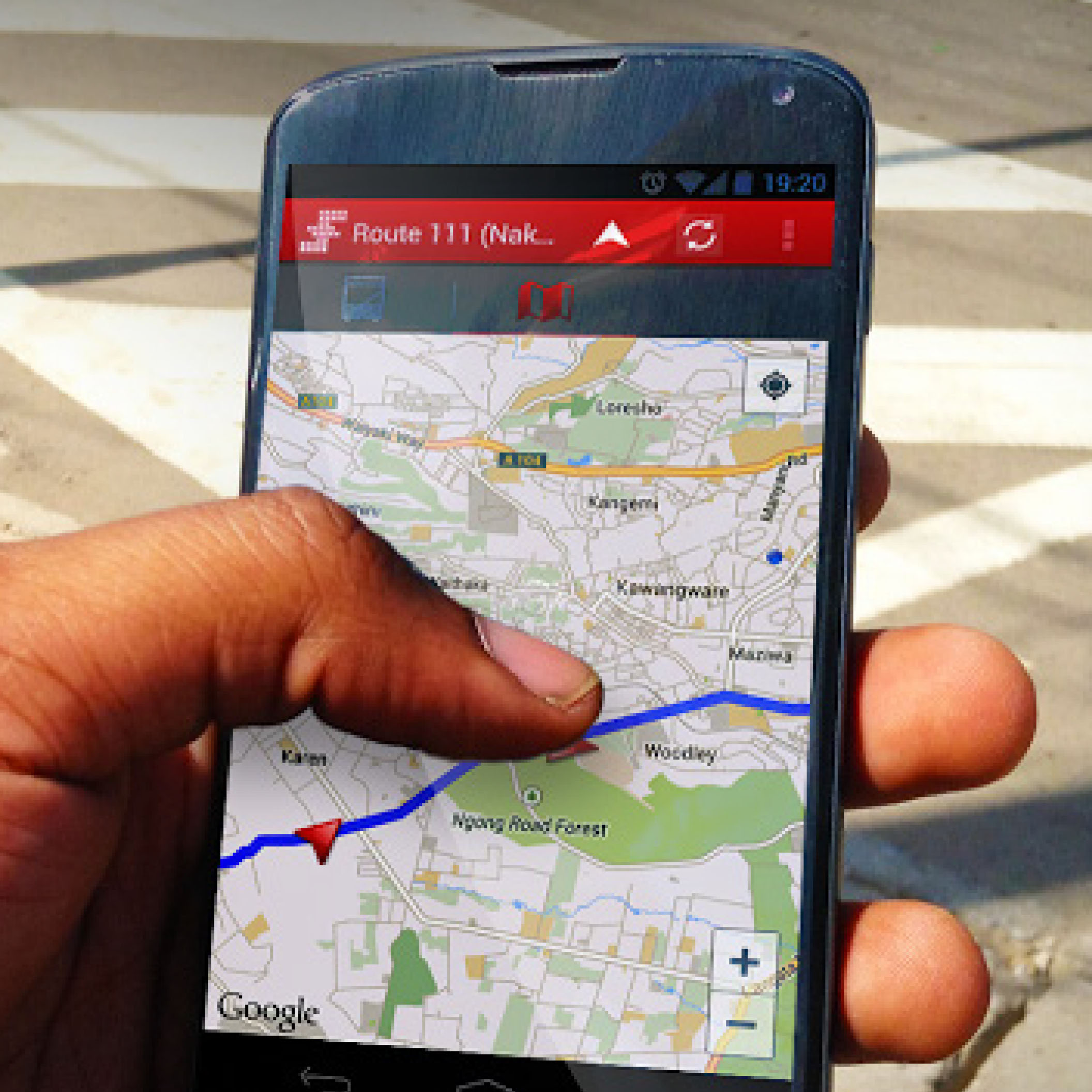
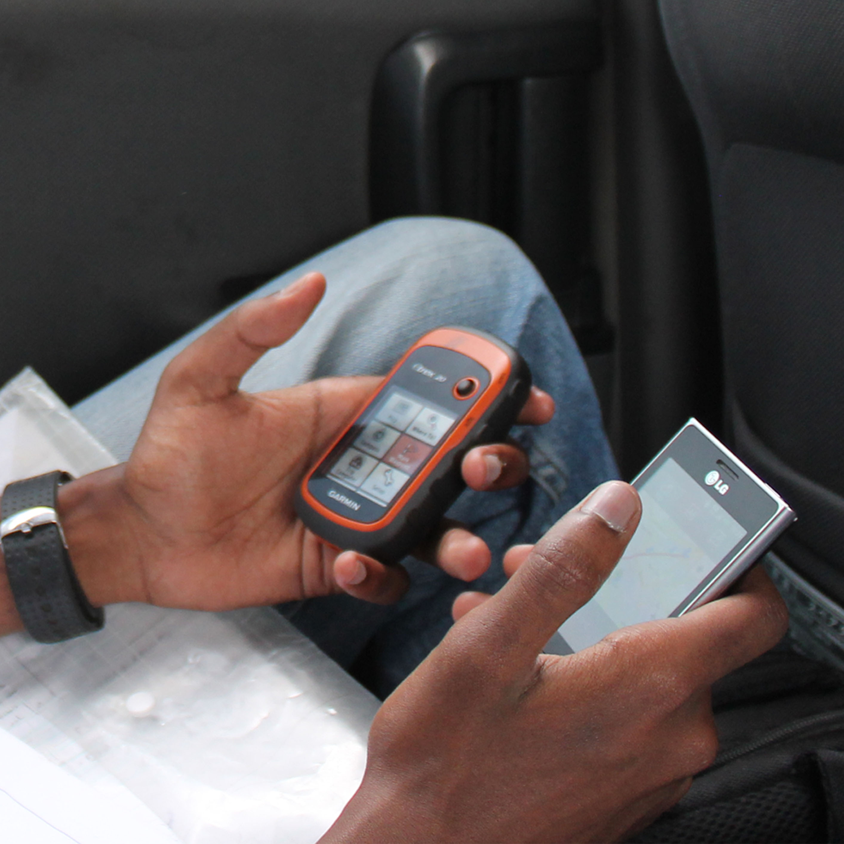
Student team members from the University of Nairobi sought out and rode matatus routes, with mobile devices in hand, and collected data using one of the pre-selected collecting apps. Students identified stops based on their personal knowledge, information from frequent users of these routes, visual notation (signs, shelters etc.), and if necessary, confirmation from discussion with an operator or group of commuters on a route.
Workshops with Transit Community
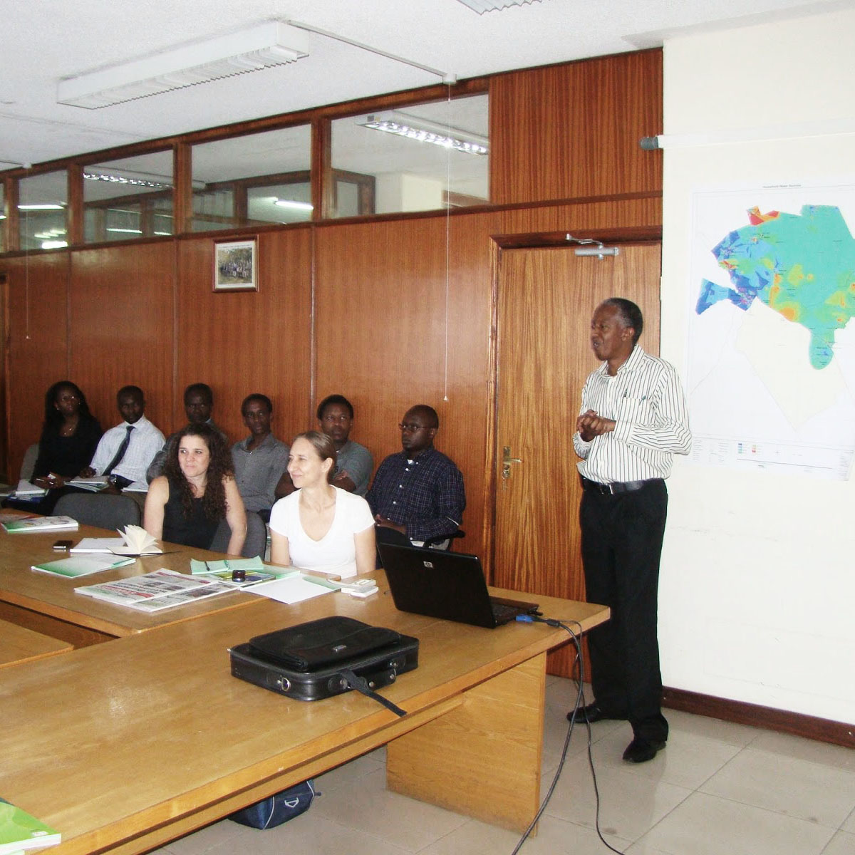
With the collected data, workshops were held with the Transit Community to gain a better insight for reading the GPS data collected through the app.
Processing Data into GTFS
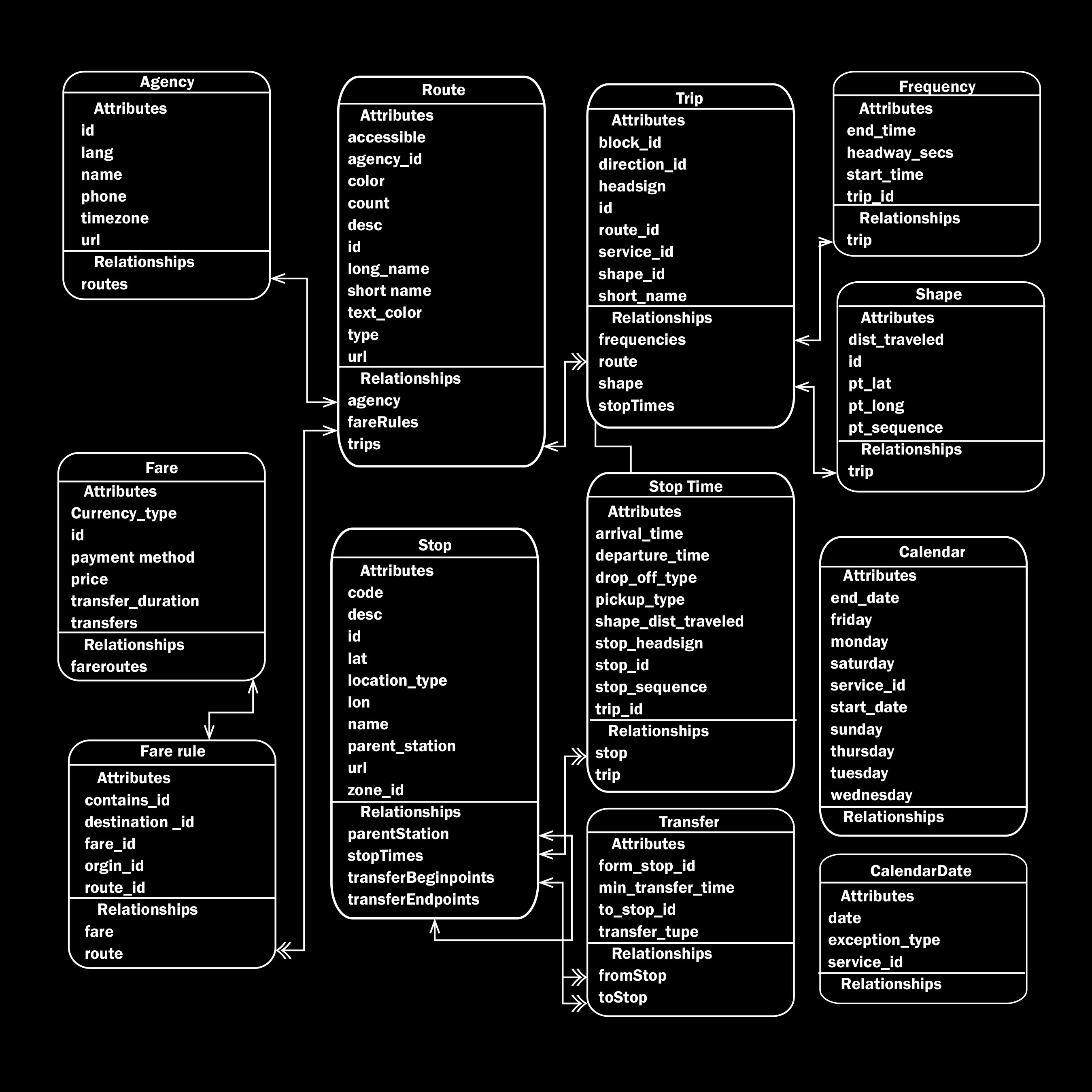
Once the data was collected, it needed to be cleaned and formatted into GTFS. However, several typically required data points for the standard simply do not exist for the matatu system—data such as calendars, service frequencies and operating schedules. In addition, fares are variable, and routes and stops can change depending on traffic patterns, police checks, commuter demands or the prevailing weather. Working with a wide group of transit specialists and advocates, we developed a modified GTFS standard that would be flexible enough for transit systems with high degrees of informality like in Nairobi.
Making of Digital Matatus Map : Part 1
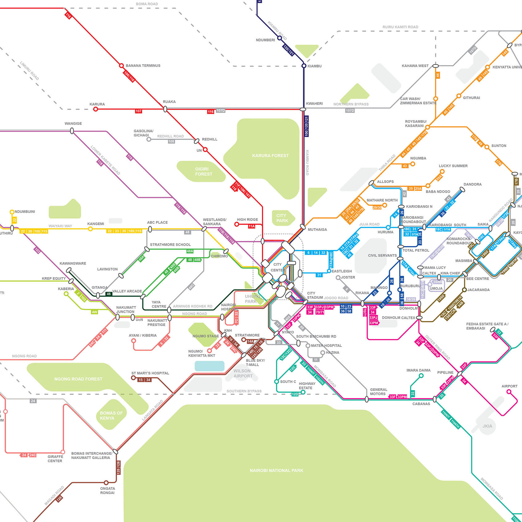
Paper Map Release
In order to help travelers situate and orient themselves, the routes are redrawn diagrammatically along 45 and 90 angles, grouped into colored lines according to where they travel within the city, and placed in between landmarks and points of interest. Six months after the release, more than 5,000 unique IP addresses downloaded the data.
Making of Digital Matatus Map : Part 2
Making of Digital Matatus Map : Part 3

Transit Application development
With new, high-quality data free and available, the technology community has developed five mobile applications that provide routing information to the public. These include Ma3route, Flashcast sonar, digitalmatatu, matatumap and more recently developed transit apps.
Tools for Planning
The City of Nairobi has recognized the transit map. The data and map provide the first comprehensive visualization of the matatu system and create a new planning tool for the city. For example the map is currently being used by UN HABITAT to help guide the Bus Rapid Transit (BRT) they are developing for Nairobi.